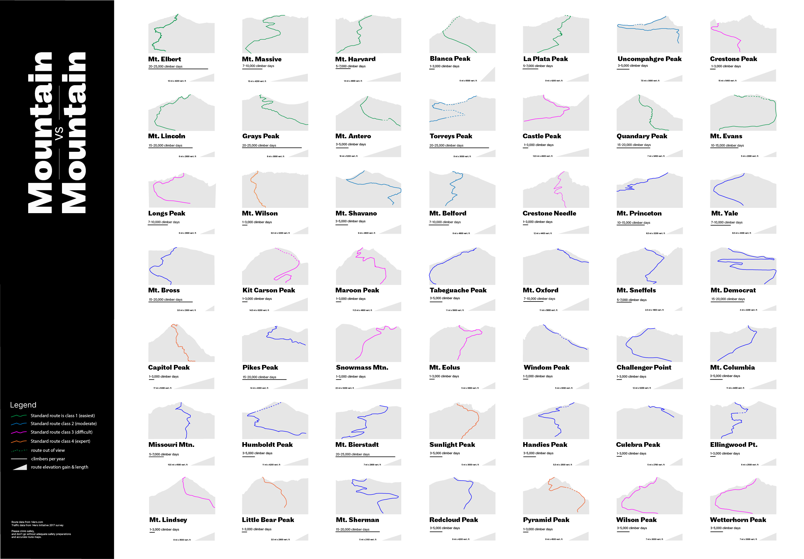
For an independent study on data analysis, I chose to present data about Colorado's tallest peaks, in a wall-sized-poster format.
Important aspects of each mountain: what does the route look like, distance to the summit, vertical elevation gain, technical difficulty of the standard route (class 1 is easy, ranging to class 4, extremely difficult), and how popular or crowded the mountain is.
Route color denotes difficulty. Peaks are shown in silhouette viewed from the side with the standard route on it. The triangle at the lower left of each peak allows quick visual comparison of length and vertical gain of each route.
you may also like...
Intern-al AppsUX Design

Sidekick: Anxiety SupportUX Design

Open Source PartyVisual Design
Not My StyleVisual Design
BikeboxUX

Artist - Brand CollabVisual Design
Colorado Fourteenersdata presentation